
Contents
- 1 From Alice Springs to Uluru: Top Hiking Trails and Walks
- 1.1 Alice Springs: Outback Gateway
- 1.2 The Larapinta Trail: One of Australia’s Great Long Distance Walks
- 1.3 Kings Canyon and Watarrka National Park
- 1.4 Kata Tjuta and the Valley of the Winds
- 1.5 Uluru Base Walk: A must do in Uluru-Kata Tjuta National Park
- 1.6 Day trips and walks from Alice Springs
- 1.7 Conclusion
- 1.8 FAQ
From Alice Springs to Uluru: Top Hiking Trails and Walks
The Red Centre is a land of rough country, old landscapes and big views. The drive from Alice Springs to Uluru is a road trip through one of the most famous parts of Australia and also a chance to walk some of the best trails in the country. Whether you join an Alice Springs to Uluru tour or go it alone you’ll find a range of walks that showcase the natural and cultural beauty of the region. Along the way you’ll pass famous landmarks like Kings Canyon, Kata Tjuta and the Larapinta Trail, each with its own opportunities to get amongst the landscape. This guide has the top trails between Alice Springs and Uluru, short walks and multi day treks so you can have the ultimate Outback adventure.
Alice Springs: Outback Gateway
Alice Springs Telegraph Station to Simpsons Gap
Distance: 24 km | Grade: Moderate
A local and tourist favourite this walk takes you from the Alice Springs Telegraph Station through rocky country and ends at the beautiful Simpsons Gap. Along the way you’ll see incredible views of the old West MacDonnell Ranges. Make sure to carry plenty of water as the desert can be unforgiving.
Mount Gillen Summit
Distance: 4 km | Grade: Hard
For the views of Alice Springs this is the walk to do. A challenging climb with great views of the town and the desert. The summit also gives you a deeper connection to the area’s cultural significance.
The Larapinta Trail: One of Australia’s Great Long Distance Walks
Section 12: Mount Sonder to Redbank Gorge
Distance: 16 km | Grade: Hard
The climb to Mount Sonder is one of the highlights of the Larapinta Trail. This popular trail has some of the best views in the Red Centre and a glimpse of Finke Gorge National Park and the East and West MacDonnell Ranges.
Ormiston Pound Walk
Distance: 7 km | Grade: Moderate
This walk goes through Ormiston Gorge and is perfect for those who want to get amongst the natural beauty of the West MacDonnell Ranges. Along this trail you’ll see the diverse landscapes that make this area a bushwalking hotspot.
Kings Canyon and Watarrka National Park
Kings Canyon Rim Walk
Distance: 6km | Moderate
The Kings Canyon Rim Walk is one of the most popular walks in the area. You get to see the canyon walls and the canyon floor below, the raw desert landscape of Australia. The views are stunning, this is a favourite of hikers. For the more fit, this is a must do.
Kings Creek Station Walk
Distance: 2-3 hours | Easy
This shorter walk has great views of Kings Canyon and is perfect for families or those who want a easier walk. The desert landscape is rich in culture and natural beauty.
Kata Tjuta and the Valley of the Winds
The Full Circuit Walk
Distance: 7.4km | Moderate to Hard
The Valley of the Winds walk through Kata Tjuta (also known as the Olgas) has stunning views of the monoliths and the desert landscape. Part of the Tjuta National Park, this walk goes through sacred Aboriginal land, managed by the traditional owners and land managers.
Walpa Gorge Walk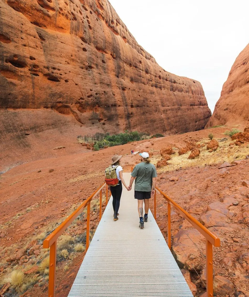
Distance: 2.6km | Easy
For a shorter but equally beautiful walk, the Walpa Gorge trail takes you into the heart of Kata Tjuta, surrounded by rock walls. The walk is short but gives you a glimpse into the cultural significance of the area.
Uluru Base Walk: A must do in Uluru-Kata Tjuta National Park
The Base Walk
Distance: 10.6km | Easy
The Uluru Base Walk is one of the most famous walks in Australia. As you walk around the 348m high red monolith, also known as Ayers Rock, you’ll see ancient rock art sites and the sacred Mutitjulu Waterhole and gain a deeper understanding of the cultural landscape.
Mala Walk
Distance: 2km | Easy
This walk is culturally rich as it explores part of the base of Uluru. The Mala Walk goes past ancient rock art, shows the beauty of the sandstone monolith and tells the story of the Anangu people.
Day trips and walks from Alice Springs
Trephina Gorge Nature Park
Distance: 3-4 hours | Easy to Moderate
15 minutes from Alice Springs, Trephina Gorge has great views and is a favourite of hikers who want to explore the East MacDonnell Ranges. The walking tracks around the gorge have stunning views of the desert.
Ellery Creek Big Hole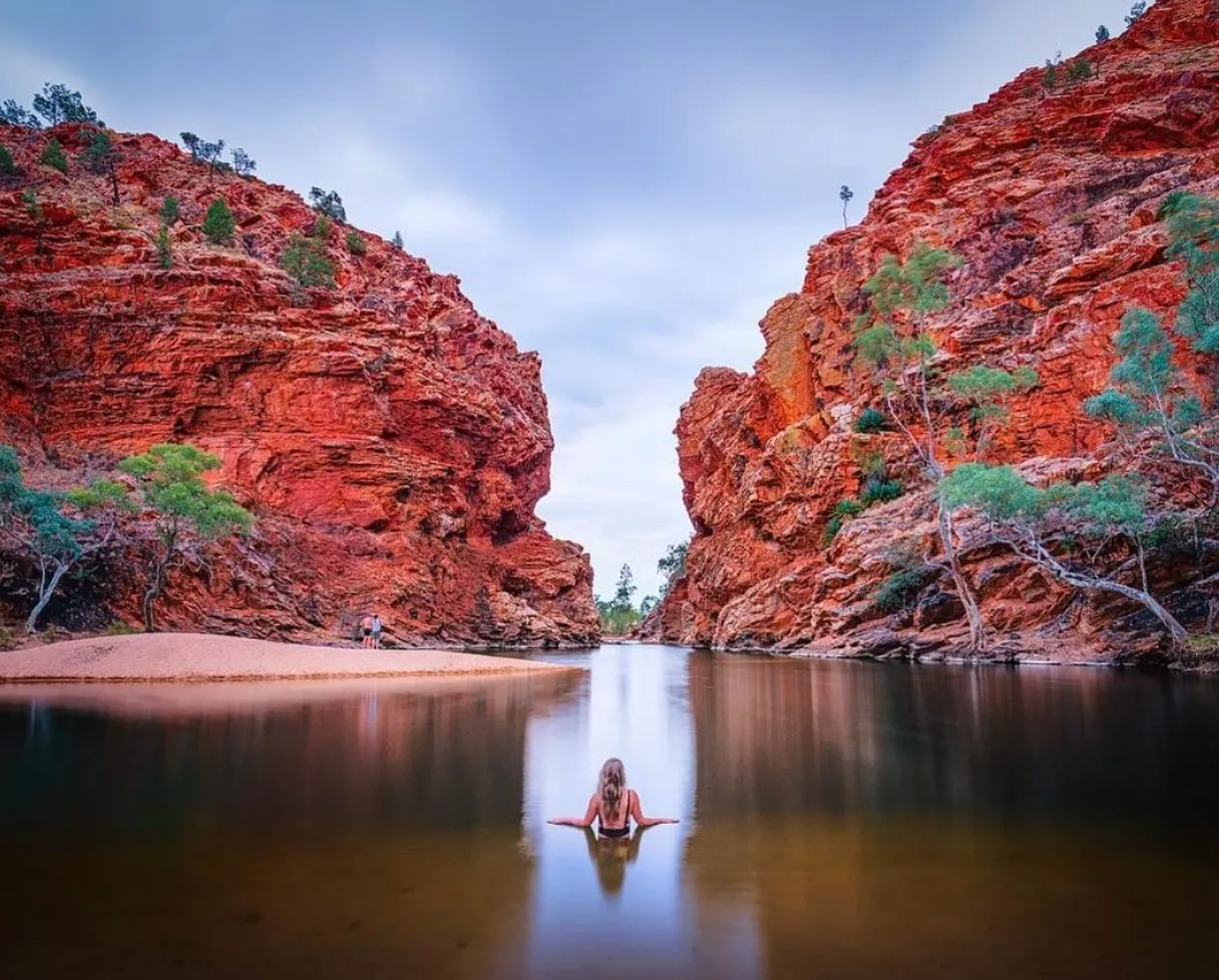
Distance: 1.5-2.5 hours | Easy
A great day trip from Alice Springs. The walk to Ellery Creek goes past beautiful creeks and you can take a swim in the cool water.
Anzac Hill Lookout
Short walk For a short easy walk with great views of Alice Springs and the desert, this is the one. Good spot to sit and reflect on the area’s history.
Conclusion
The drive from Alice Springs to Uluru has some of the best hiking in the world. From the Larapinta Trail to the Uluru walks, these trails show off the ruggedness, cultural significance and beauty of Australia’s Red Centre. Whether you’re after a day walk or a multi day bushwalk there’s a trail for you.
FAQ
When is the best time to hike in the Red Centre?
April to September. It’s cooler.
What fitness level is required for Kings Canyon Rim Walk?
Moderate. Steep and rocky.
Are there guided tours for hiking in Uluru-Kata Tjuta National Park?
Yes for many of the walks including Uluru Base Walk and Valley of the Winds.
How long does the Larapinta Trail take?
The Larapinta Trail takes 12-15 days to do in full but shorter sections can be done in 2-3 days or as day walks.
Can I camp on the trails?
Yes in designated areas along the Larapinta Trail but check for any regulations or booking services.